
Tag: GeoSpatial Stream

3_19 Infrastructure Broadcast (NYC Gas Explosion, Canada vs. U.S. Infrastructure and More)
3.42K Views0 Comments0 Likes
This infrastructure-focused GeoSpatial Stream broadcast discusses the gas-leak explosion in New York City; the state of the U.S. infrastructure; Canadian investment; announcements from the Smart Grid Innovation Hub, Bentley Systems, Esri, Oracle and Topcon Positioning Group; and more.
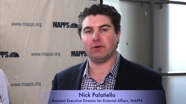
Nick Palatiello Interview
3.43K Views0 Comments0 Likes
Matt Ball interviews Nick Palatiello, Assistant Executive Director for External Affairs, MAPPS. They discuss the lobbying organization's history, agenda and how it works with government officials to advocate for the geospatial profession.

7_1 Drones Broadcast (SPOT 7, Minerals Cadastre and More)
3.43K Views0 Comments0 Likes
This GeoSpatial Stream broadcast discusses the banning of drones from U.S. National Parks; the launch of SPOT 7; a Tanzanian effort to improve its mining cadastre; the first private Russian remote-sensing satellite; industry news from IMAGINiT Technologies, GeoVille, CartoDB, Esri and Boundless; an article in Sensors & Systems; and more.

5_8 Infrastructure Broadcast (ETOD, Global Smart City Rankings and More)
3.43K Views0 Comments0 Likes
This infrastructure-focused GeoSpatial Stream broadcast discusses Equitable Transit-Oriented Development (ETOD); a Global Smart City Ranking; the King County Multi-Family Residential Parking Calculator; historic Denver Union Station's transit makeover; GEOSS; news from Bentley Systems, Esri, Leica Geosystems and Agency9; and more.

4_14 Infrastructure Broadcast (Transportation Asset Management, Water Infrastructure Needs, and More)
3.51K Views0 Comments0 Likes
This infrastructure-focused GeoSpatial Stream broadcast discusses Transportation Asset Management; a report on water infrastructure; designs to protect against hurricanes; public-transit ridership; historical map archives; private infrastructure funding; news from Bluesky and Bentley Systems; rainwater-capturing infrastructure in Rotterdam, The Netherlands; and more.

Patrick Collins Interview
3.55K Views0 Comments0 Likes
Matt Ball interviews Patrick Collins, Technical Solutions Engineer, Exelis Visual Information Solutions. They discuss the increasing size of LiDAR data and the tools to handle such volume as well as the variety of ways image data can be analyzed, including automated feature extraction.
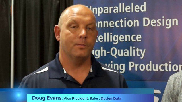
Design Data Adds Intelligence to Crane Modeling
3.60K Views0 Comments0 Likes
Todd Danielson interviews Doug Evans, Vice President, Sales, Design Data, at the HxGN LIVE event in Las Vegas, Nevada. They discuss sharing models with Intergraph software for production and manufacturing, its new SDS/2 Erector product that adds intelligence to crane modeling and building, and more.
GeoSpatial Stream 11_18 (protected areas, geolocated tweets, infrastructure investment and more)
3.61K Views0 Comments0 Likes
This Daily Digest was published on 11/18/2013. Topics covered include identifying protected habitat areas, satellite imagery legislation, geolocated Tweets to reveal travel patterns, Indonesian infrastructure investment, and more.

Ron Roth and Anders Ekelund Interview
3.63K Views0 Comments0 Likes
Matt Ball interviews Ron Roth, product manager, Airborne LiDAR, Leica Geosystems, and Anders Ekelund, managing director, Airborne Hydrography AB. They discuss Leica's acquisition of Airborne Hydrography AB and the bathymetric products the company creates, including its Chiroptera system.
4_28 Asia-Pacific Broadcast (Great Barrier Reef, Asian Satellites, CityNext and More)
3.64K Views0 Comments0 Likes
This Asia-Pacific-focused GeoSpatial Stream broadcast discusses a new way to monitor the Great Barrier Reef from space, GLONASS updates, a new Indian navigation satellite, CityNext in Surat, the latest industry headlines, and more.


