
Tag: GeoSpatial Stream

Jack Dangermond Addresses Climate Change and the Importance of GeoDesign (3 of 4)
9.45K Views0 Comments0 Likes
In the third of four installments, Todd Danielson interviews Jack Dangermond, President and Founder, Esri, at the 2014 Esri User Conference in San Diego. Jack talks about the Climate Resilience App Challenge, meeting the president and working on climate issues, and the importance of GeoDesign and its growing acceptance and use.

IMAGINiT Helps Clients through Entire Workflow
2.33K Views0 Comments0 Likes
Todd Danielson interviews Dan Chapek, Manager, Infrastructure Solutions Team, IMAGINiT, and Jeff Bowers, Consultant, Business Solutions, IMAGINiT, at the HxGN LIVE event in Las Vegas, Nevada. They discuss how to integrate scanning data into design applications to create client deliverables, how the company partners with Leica Geosystems and Autodesk products, "field to finish" workflows, and more.

ikeGPS Demonstrates New Spike Device at Esri UC
4.03K Views0 Comments0 Likes
Brian Soliday, Senior VP of Sales, ikeGPS, demonstrates the company's new Spike measurement device at the 2014 Esri User Conference in San Diego. Featuring a laser, accelerometer and 3-D compass, combined with a camera and GPS, Spike provides and quick and easy way to "measure the world around you."
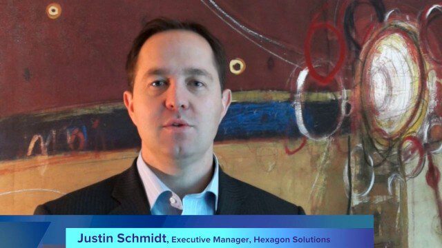
Hexagon’s Schmidt Discusses Water Solutions
2.95K Views0 Comments0 Likes
Todd Danielson interviews Justin Schmidt, Executive Manager, Hexagon Solutions, at the HxGN LIVE event in Las Vegas, Nevada. They discuss the Hexagon Smart H2O Solution (the foundation for Hexagon Solutions), complete water systems and their challenges, dam monitoring and failures, and more.

Hexagon Solutions CEO Discusses Growing Marketplace
2.69K Views0 Comments0 Likes
Todd Danielson interviews Claudio Simão, President and CEO, Hexagon Solutions, at the HxGN LIVE event in Las Vegas, Nevada. They discuss the goals of Hexagon Solutions in terms of market needs, this evolving division within Hexagon, the ripe environment for acquisitions, and more.
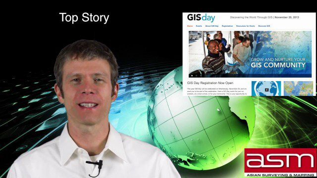
GIS Day Broadcast 11_20 (Free Sentinel imagery, Czech Cadastre, Google Explore and more)
3.05K Views0 Comments0 Likes
This GeoSpatial Stream celebrates GIS Day, discusses U.S. government initiatives, the decision to release free Sentinel satellite imagery, Czech Cadastre news, Google Explore and more.
GeoSpatial Stream Broadcast from London
3.76K Views0 Comments0 Likes
Reporting from London, Todd Danielson covers the important announcements from the Bentley Year In Infrastructure Conference, the Bentley 500 list of top infrastructure owners worldwide, Bentley's acquisition of MOSES Software, a new columnist for Sensors & Systems, and more.

GeoSpatial Stream Adds Facebook Page
7.79K Views0 Comments0 Likes
GeoSpatial Stream introduced a new Facebook page at https://www.facebook.com/geospatialstream.
GeoSpatial Stream 11_18 (protected areas, geolocated tweets, infrastructure investment and more)
3.61K Views0 Comments0 Likes
This Daily Digest was published on 11/18/2013. Topics covered include identifying protected habitat areas, satellite imagery legislation, geolocated Tweets to reveal travel patterns, Indonesian infrastructure investment, and more.
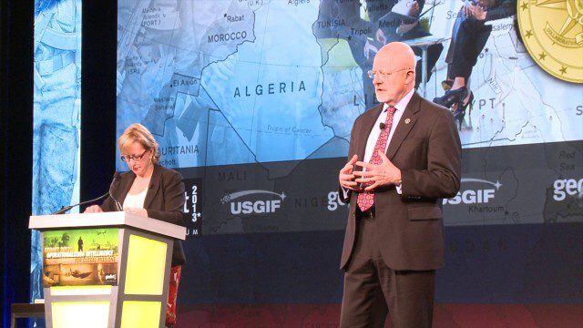
GEOINT Keynote: James Clapper, Director of National Intelligence (Part 4/Q&A)
2.89K Views0 Comments0 Likes
Part 4 of the GEOINT Symposium keynote address from James Clapper, Director of National Intelligence, completing the Q&A session.


