
tdanielson / Added Videos
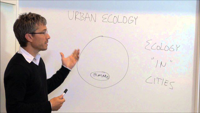
Urban Ecology
1.85K Views0 Comments0 Likes
An assistant professor at the New School in New York discusses and explains urban ecology.
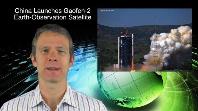
8_27 Asia-Pacific Broadcast (Infrastructure, Alibaba and More)
4.11K Views0 Comments0 Likes
This Asia-Pacific-focused GeoSpatial Stream broadcast discusses infrastructure topics such as new financing in India, water monitoring in China, and a Chinese offer to help upgrade U.S. transportation systems; an urban-renewal project in Melbourne; China's successful launch of the Gaofen-2 Earth-observation satellite; industry news from Alibaba, Google, Maestro Wireless Solutions and CSR; drones helping China recover from an earthquake; Japanese microsatellites; and more.
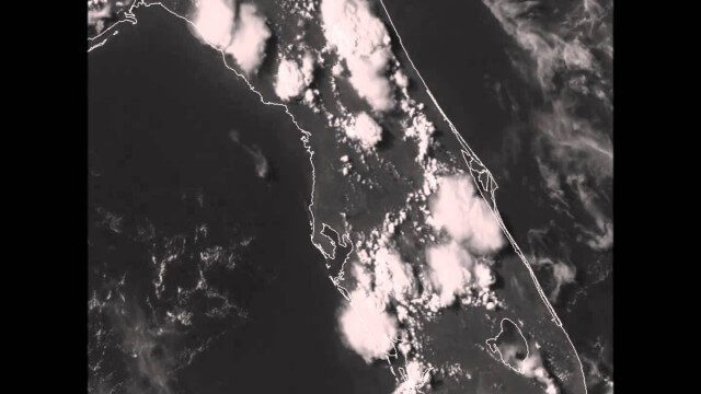
GOES-14 VIS Imagery over Florida
2.11K Views0 Comments0 Likes
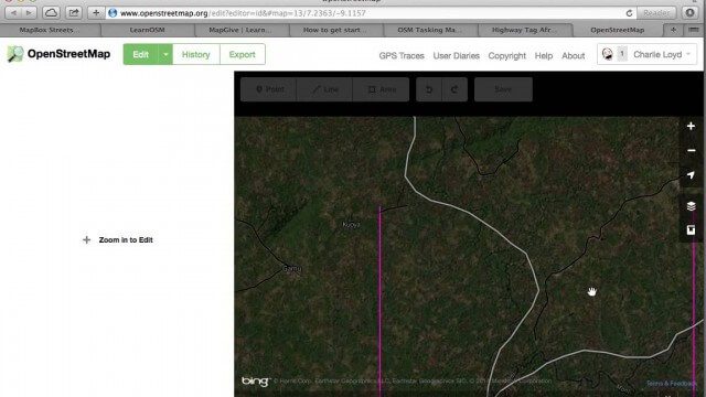
Tracing Demonstration for the Humanitarian OpenStreetMap Team (HOT)
1.53K Views0 Comments0 Likes
This is a simple demonstration of what it looks like to trace for the Humanitarian OpenStreetMap Team (HOT). It’s not meant as a full guide, just an example. If I’m too mumbly, please turn on the captions – the CC button below the video.

What Is the Geodesign Summit?
29.98K Views6 Comments0 Likes
Esri's annual Geodesign Summit has been a key element in moving the geodesign movement forward. This video from GeoSpatial Stream summarizes some of the important geodesign concepts as well as how Esri's conference informs and motivates those interested in designing a better and smarter built environment.
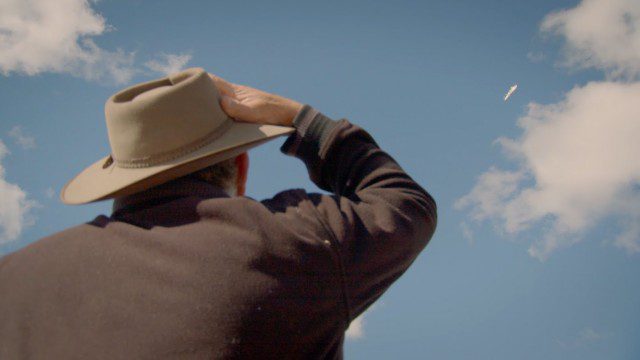
Introducing Google’s Project Wing
4.09K Views0 Comments0 Likes
Project Wing is a Google[x] project that is developing a delivery system that uses self-flying vehicles. As part of our research, we built a vehicle and traveled to Queensland, Australia for some test flights. There, we successfully delivered a first aid kit, candy bars, dog treats, and water to a couple of Australian farmers. We’re only just beginning to develop the technology to make a safe delivery system possible, but we think that there’s tremendous potential to transport goods more quickly, safely and efficiently.
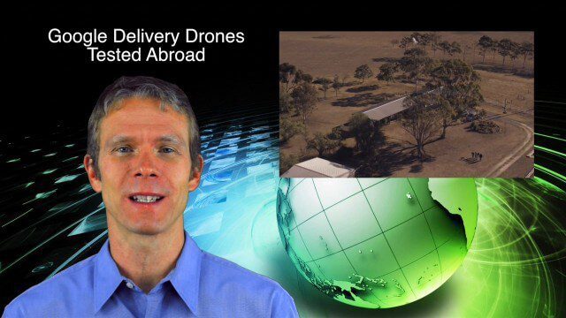
9_4 Earth Imaging Broadcast (Galileo Malfunction, Drones and More)
6.51K Views0 Comments0 Likes
This Earth imaging GeoSpatial Stream broadcast discusses the ESA's potentially lost Galileo navigation satellites; several instances of drones (or UAVs) making news worldwide, including from Google and Amazon; industry news from DigitalGlobe, BlackBridge and MDA, SimActive, and KEYW Corp.; URISA's GIS-Pro conference in New Orleans; subscription information; and more.
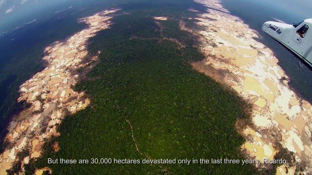
Shocking Images of Environmental Devastation in Peruvian Rainforest
3.12K Views0 Comments0 Likes
Güido Lombardi, a Peruvian journalist, tells in his news radio program at RPP Noticias the impressions that he got after overflying the affected areas by the illegal mining in Madre de Dios, in the Peruvian rainforest. These images where captured by the Carnegie Airborne Observatory.
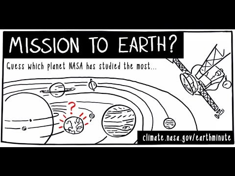
NASA’s Earth Minute: Mission to Earth?
1.69K Views0 Comments0 Likes
NASA doesn't just explore outer space! Since 1959, with the launch of the first weather satellite, NASA has been studying our home planet on a global scale. NASA monitors Earth's vital signs via satellites and airplanes, sends scientists to the far corners of the land and under the ocean, and develops computer models of Earth's climate processes. Why? Because Earth is the only planet that nearly eight billion people call "home sweet home."
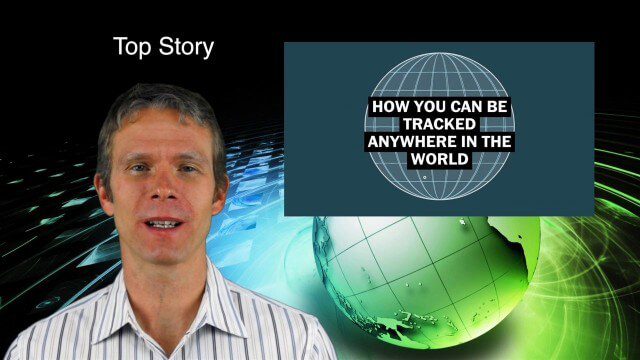
9_10 Location Surveillance Broadcast (Phone Tracking, Global Road Map and More)
4.33K Views0 Comments0 Likes
This GeoSpatial Stream broadcast discusses location surveillance and how portals are providing cellphone locations as a paid service; the Global Road Map and its quest to limit environmental impact; Canada's investment in a global survey of surface water; NATO's Joint Intelligence, Surveillance and Reconnaissance capability; industry news from Esri, Ocean Optics and PCI Geomatics; opinions on location surveillance; and more.


