
Monthly Archives: May 2014
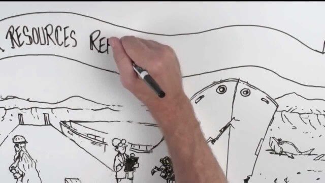
Whiteboard: How to Reform Water Infrastructure
1.92K Views0 Comments0 Likes
The Water Resources Reform and Development Act (WRRDA) of 2013 promotes our Nation's competitiveness, prosperity, and economic growth by upholding the seminal federal responsibility to maintain a strong transportation infrastructure and ensure the efficient flow of domestic and international commerce.
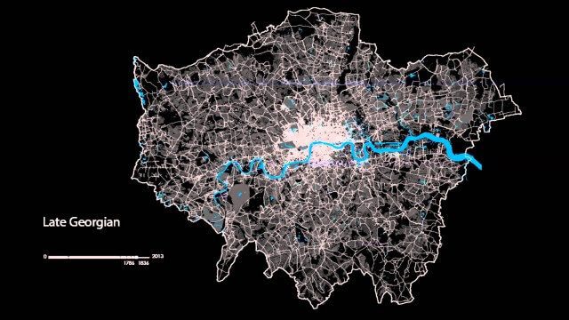
The London Evolution Animation
1.96K Views0 Comments0 Likes
The London Evolution Animation (LEA) shows the historical development of London from Roman times to today, using georeferenced road network data brought together for the first time. The animation also visualizes (as enlarging yellow points) the position and number of statutorily protected buildings and structures built during each period.
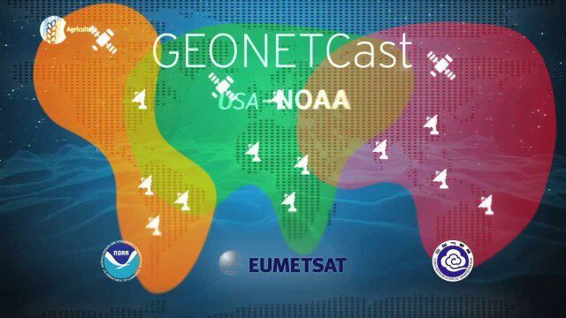
GEOSS Functions and Main Components
2.05K Views0 Comments0 Likes
Infrastructure and Data: The Global Earth Observation System of Systems (GEOSS) functions and main components, sustainability, user access and benefits.
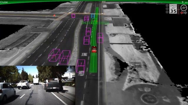
Google Self-Driving Car on City Streets
2.48K Views0 Comments0 Likes
The Google self-driving car navigates some common scenarios on city streets near the Googleplex.

Google Glass Explorer Story: WWF’s Sabita Malla
2.58K Views0 Comments0 Likes
WWF's Sabita Malla is exploring how Glass can help protect rhinos.
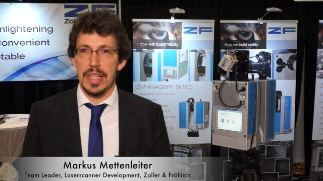
Simon Kresser and Markus Mettenleiter (Z+F) Interview
3.01K Views0 Comments0 Likes
Matt Ball interviews Zoller and Fröhlich's Simon Kresser, Marketing, and Markus Mettenleiter, Team Leader, Laserscanner Development, at SPAR International in Colorado Springs, Colo. They discuss Z+F's new laserscanner features and accessories, company goals, a product tour, thermal cameras and uses, and more.

Doug Smith Interview (Avenza Systems)
3.07K Views0 Comments0 Likes
Todd Danielson interviews Doug Smith, Director, Sales & Marketing, Avenza Systems, at the GEOINT Symposium in Tampa, Florida. They discuss Avenza's key products, including MAPublisher, Geographic Imager and its new PDF Maps app. All the products work with Adobe products for increased design functionality while maintaing location integrity.

Denver Marks Third Stop of Topcon Roadshow
3.14K Views0 Comments0 Likes
Topcon takes their technology on the road with a mobile theater and technology showcase, coupled with field demonstrations. The free event hits 24 North American cities from early May through October. The event is aimed at the construction, survey, civil engineering, architecture and design industries. This short video summary recaps the May 2 tour stop in Denver, hosted by local dealer partner GeoShack.

Jon Skiffington Interview (LizardTech)
3.19K Views0 Comments0 Likes
Todd Danielson interviews Jon Skiffington, Director, Product Management, LizardTech, at the GEOINT Symposium in Tampa, Florida. They discuss LizardTech's MrSID product and how it compresses imagery and other large datasets, GEOINT imagery users, GeoExpress and Express Server 9, and the company Web site.

Tim Lemmon and Todd Steiner Interview (Trimble)
3.23K Views0 Comments0 Likes
Matt Ball interviews Trimble's Tim Lemmon, Marketing Director, Geospatial Software Solutions, and Todd Steiner, Marketing Director, Geospatial Imaging Solutions, at SPAR International in Colorado Springs, Colo. They discuss Trimble's integration between hardware and software so customers can make better business decisions, the changing role of the surveyor, and a variety of new hardware and software products.


