
Tag: video
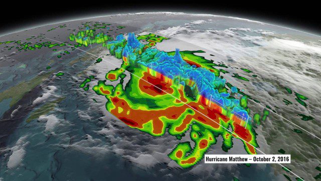
NASA’s 3D View Shows Hurricane Matthew’s Intensity
1.34K Views0 Comments0 Likes
NASA scientists used satellite data to peer into Hurricane Matthew, learning how and why the massive storm changed throughout its course.
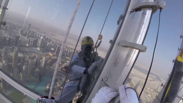
The LED Exterior Facade of Burj Khalifa Uncovered
1.50K Views0 Comments0 Likes
Facts uncovered by a dedicated team of specialized engineers. All you need to know about the largest LED screen in the world covering the world's tallest tower's facade.

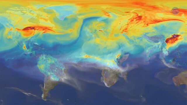
9_27 Climate Change Broadcast (Latest Data, Satellite Launches and More)
1.92K Views0 Comments0 Likes
This GeoSpatial Stream looks at the latest data on climate change from NOAA and NASA, including more record temperatures, flooding and shrinking sea ice; new satellites from Google's Terra Bella and Peru; Esri's new way of measuring oceans: the EMU; industry news from Phase One Industrial, TerraGo, Datumate and Satlab Geosolutions; a video of drone imaging for ESA's deep-space tracking system; and more.

Software Aids Stormwater and Sewage Infrastructure Design
1.36K Views0 Comments0 Likes
Urbano software is used for the design of sewage and water distribution networks. Urbano Canalis is the module used for design of storm and sanitary sewage systems. You can create complete storm and sanitary sewage system designs, starting from the initial network definition to the analysis of hydraulic results.
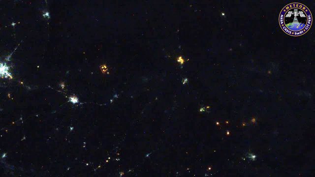
Meteors Encountering Earth’s Atmosphere
1.54K Views0 Comments0 Likes
This video was acquired August 10, 2016, with a high-resolution video camera onboard the International Space Station (ISS). Within the span of about 10 seconds, two meteors associated with the Perseid meteor shower streak across the sky above Pakistan. Video was provided by Tomoko Arai/Japan’s Planetary Exploration Research Center/Meteor Composition Determination (Meteor) investigation.

Google Geospatial Technologist Talks Trends
1.53K Views0 Comments0 Likes
INTERGEO TV interviews Ed Parsons, geospatial technologist at Google, about his thoughts on the future of the map and related technology.
Reshuffling Heat on a Warming Planet
1.51K Views0 Comments0 Likes
Earth's oceans could be concealing a mystery about climate change. Researchers have recently found evidence of hidden heat hundreds of meters below the ocean's surface.

8_4 Infrastructure Broadcast (TIGER Grants, Transit Tech and More)
2.29K Views0 Comments0 Likes
This Infrastructure-themed GeoSpatial Stream broadcast discusses $500 million in grants from the USDOT's TIGER program; highlights from the latest issue of Informed Infrastructure magazine; new virtual reality technology to promote transit; industry news from Pix4D, Thinkbox Software and the Global Infrastructure Hub; a video from the Mississippi Watershed Management Organization about a stormwater filtration system recently installed near Minneapolis; and more.

NASA Sees Intense Fires around the World
1.43K Views0 Comments0 Likes
This year’s wildfire season is off to a blazing start. The United States had an early start to the season, with more than 29,000 wildfires burning more than 2.6 million acres of land. The driest season in 14 years has left the southern Amazon primed for heavy wildfire activity as well.
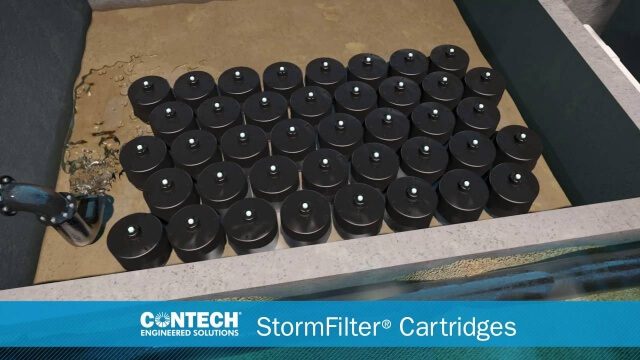
St. Anthony Regional Stormwater Treatment and Research System
1.30K Views0 Comments0 Likes
An estimated 169 million gallons of polluted stormwater runoff will be captured and treated each year by this underground facility on the border of Minneapolis and St. Anthony Village. It is projected to cut pollution levels by more than half for stormwater runoff flowing from the southern half of St. Anthony Village to the Mississippi River. Learn more at http://mwmo.org/sav


