
Tag: Landsat
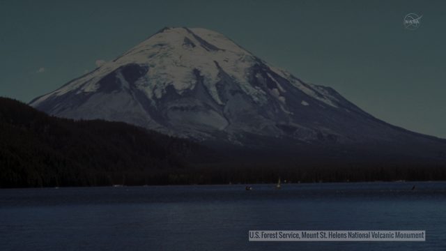
Landsat Tracks Mount St. Helens Recovery
0 Views0 Comments0 Likes
By observing different wavelengths of light reflected off the surface, Landsat data can identify different types of land cover.
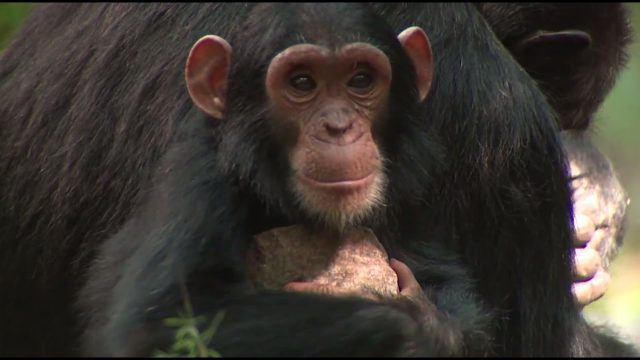
NASA Partners with Jane Goodall Institute to Protect Chimpanzees
0 Views0 Comments0 Likes
Data from Landsat satellites, a joint mission of NASA and the U.S. Geological Survey, have been critical to helping the Jane Goodall Institute in their work to protect chimpanzees and their habitat. In this video, Goodall and JGI scientist Lilian Pintea discuss the transformational role of seeing changing habitats from above.

6_25 Hurricane Broadcast (Infrastructure Spending, Iraq and More)
0 Views0 Comments0 Likes
This GeoSpatial Stream broadcast discusses the 2014 hurricane season; infrastructure spending predicted to increase to $9 trillion by 2025; a Landsat image of Iraq; the Dutch Water System; industry news from Eagle Mapping, Riegl, E-Capture R&D, Esri, Blue Marble Geographics and URISA; and more.

NASA | Landsat Tracks Urban Change and Flood Risk
0 Views0 Comments0 Likes
NASA | Landsat Tracks Urban Change and Flood Risk


