
Tag: Internet
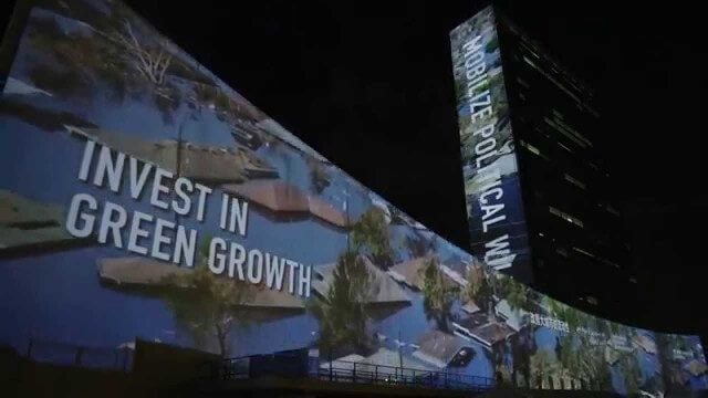
illUmiNations: Protecting our Planet
1.96K Views0 Comments0 Likes
United Nations General Assembly and Secretariat buildings lit up on Saturday night in a revolutionary call for climate action in connection with the Secretary-General's climate Summit. #climate2014. "illUmiNations: Protecting Our Planet" was collaboratively designed and produced for UNDPI by the Oceanic Preservation Society, Obscura Digital and Insurgent Media.

FCC Geographer Byrne Receives Medal for National Broadband Map
2.60K Views0 Comments0 Likes
As the FCC’s geographic information officer, Michael Byrne helped create online maps and present data in ways that have made enormous amounts of information instantly available to consumers, citizen-activists and policymakers, and provided the business community with facts to make more informed commercial decisions.
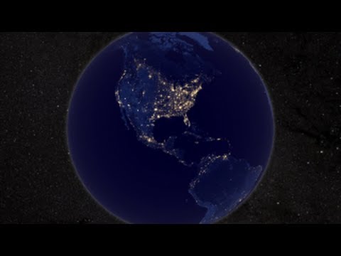
NASA Earth at Night
2.56K Views0 Comments0 Likes
In daylight our big blue marble is all land, oceans and clouds. But the night - is electric. This view of Earth at night is a cloud-free view from space as acquired by the Suomi National Polar-orbiting Partnership Satellite (Suomi NPP).

NASA NIMBUS: Recovering the Past
2.30K Views0 Comments0 Likes
50 years ago, NASA launched Nimbus to study Earth from space. Now, experts at the National Snow and Ice Data Center (part of CIRES), are recovering valuable data and images from old, long-lost film, and expanding their understanding of sea ice in the Arctic and Antarctic. Learn more from CIRES on the 1-year anniversary of Nimbus' first image:

NASA Intro to LIDAR
2.30K Views0 Comments0 Likes
Want to know the 3D shape of terrain on another planet? Want to study the height and density of Earth's forests? An amazing tool called LIDAR can help! Learn more in this video.
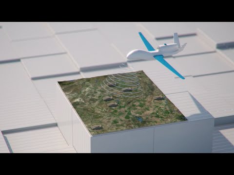
How Joint Intelligence, Surveillance and Reconnaissance Works
2.08K Views0 Comments0 Likes
NATO continues to develop key capabilities to protect the security and freedom of its members. Joint Intelligence, Surveillance and Reconnaissance (JISR) is one of these capabilities. It is a combination of processes, systems, and people, including air, ground, maritime, and space assets, which feed into one “fused” report.
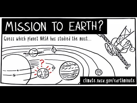
NASA’s Earth Minute: Mission to Earth?
1.69K Views0 Comments0 Likes
NASA doesn't just explore outer space! Since 1959, with the launch of the first weather satellite, NASA has been studying our home planet on a global scale. NASA monitors Earth's vital signs via satellites and airplanes, sends scientists to the far corners of the land and under the ocean, and develops computer models of Earth's climate processes. Why? Because Earth is the only planet that nearly eight billion people call "home sweet home."
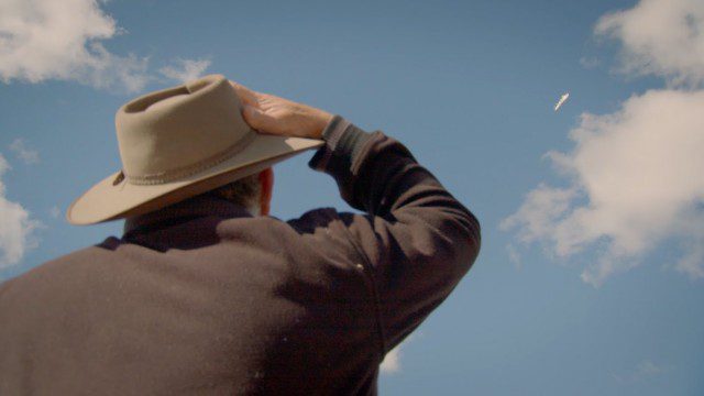
Introducing Google’s Project Wing
4.09K Views0 Comments0 Likes
Project Wing is a Google[x] project that is developing a delivery system that uses self-flying vehicles. As part of our research, we built a vehicle and traveled to Queensland, Australia for some test flights. There, we successfully delivered a first aid kit, candy bars, dog treats, and water to a couple of Australian farmers. We’re only just beginning to develop the technology to make a safe delivery system possible, but we think that there’s tremendous potential to transport goods more quickly, safely and efficiently.
LiDAR – Introduction to Light Detection and Ranging
2.67K Views0 Comments0 Likes
This video presents LiDAR of light detection and ranging, an active remote sensing system that uses laser energy, to measure the heights of objects like trees and buildings and even the ground. This video was developed by the National Ecological Observatory Network (www.neoninc.org).


