
Tag: Esri UC

Topcon Products Enable Mapping from Ground, Air and Vehicles
0 Views0 Comments0 Likes
Todd Danielson interviews Barbara McInerney, Product Marketing Manager, Topcon GeoPositioning Solutions Group, at the 2014 Esri User Conference in San Diego. They discuss Topcon's GIS and mapping solutions in three main areas: from the ground, from the air and in a vehicle.
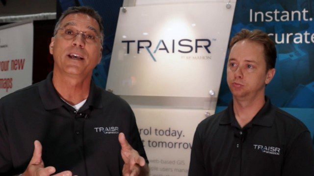
Traisr Makes Asset Management Simple, Safe and Secure
0 Views0 Comments0 Likes
Todd Danielson interviews John DePalma, Principal, and Brian Berdel, Chief Information Officer, McMahon Associates Inc., at the 2014 Esri User Conference in San Diego. They discuss the company's new product, Traisr, which integrates with multiple platforms to monitor fixed and mobile assets as well as deliver consumer Web portals.
7_30 Spatial Broadcast (Esri UC Highlights, NASA News and More)
0 Views0 Comments0 Likes
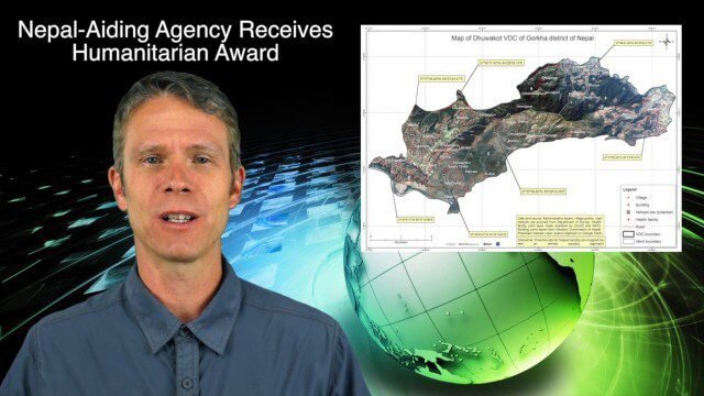
This GeoSpatial Stream broadcast discusses highlights from the Esri User Conference; NASA news from the Kepler mission and a near-Earth-sized planet as well as satellite data noting plankton's effects on clouds and climate; industry news from SAP, Esri, Nepal and LizardTech; thoughts on the Kepler mission and the possibilities of life beyond Earth; and more.

Creating 3D Models from Drone Imagery
0 Views0 Comments0 Likes
The V1 Video team interviewed Antoine Martin, Business Manager of Pix4D’s operations in the United States, at the 2015 Esri User Conference in San Diego. We spoke about the growing interest in creating useful data from drone platforms as well as the many use cases for Pix4Dmapper software for automated image processing. The company has focused on the simplification of photogrammetric science to enable users to create accurate maps and 3D models from this imagery.
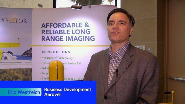
Hybrid VTOL Drone Eases Takeoff and Landing
0 Views0 Comments0 Likes
The V1 Video team interviewed Eric Westreich, who works on Business Development at Aerovel, at the 2015 Esri User Conference in San Diego. We spoke about the unique Aerovel Flexrotor hybrid-electric vertical takeoff and landing (VTOL) craft that can take off and land vertically, rotating its flight to cover more ground and takeoff from a moving platform. The Aerovel Flexrotor comes from a marine legacy, where runways aren’t possible other than on an aircraft carrier.

Trimble Discusses Mobile Device Evolution and Flexibility for Precision
0 Views0 Comments0 Likes
The V1 Video team interviewed Matt van Doorn, Product Manager in Trimble’s Geospatial Division, at the 2015 Esri User Conference in San Diego. We spoke about the rugged requirements of a professional device vs. a smartphone for field data collection. The market is good for both approaches, pairing a smartphone via a bluetooth device for high-precision collection.

Delivering Very-High-Resolution Imagery for Densely Populated Areas
0 Views0 Comments0 Likes
The V1 Video team interviewed Paul Peterson, senior vice president, Product & Engineering, nearmap, at the 2015 Esri User Conference in San Diego. The aerial imagery and visual analytics company provides timely, high-resolution and historic imagery that they recently imported to the United States from Australia. The unique sensing capacity and frequent revisits of major cities is accompanied by online analysis tools.

Data Enablement for Better Decision Making
0 Views0 Comments0 Likes
The V1 Video team interviewed Don Murray, Co-Founder and President of Safe Software, at the 2015 Esri User Conference in San Diego. We spoke about transforming geospatial data into different formats such as Minecraft for greater community engagement as well as combining buildings and GIS data for greater context. Safe Software is all about data, allowing for analysis, processing, storing and integrating data for better decision making.

6_30 Drones and GIS Broadcast (FAA Rule, Esri UC and More)
0 Views0 Comments0 Likes
This GeoSpatial Stream broadcast discusses the landmark FAA Rule Part 107 for small UASs/UAVs/drones and its effect on the U.S. economy; highlights from the 37th Esri User Conference in San Diego; industry news from SmarterBetterCities, Trimble, Cadcorp and Esri; an Esri video that opened the recent UC; and more.


