


Category: Space Symposium
A Revolution in the Value of Remote Sensing
0 Views0 Comments0 Likes
The V1 Video team interviewed Bill Gattle, President of Space and Intelligence at Harris Corp., at the 32nd Space Symposium held April 11-14, 2016, in Colorado Springs, Colo. He discusses the worldwide value transformation seen in remote sensing, the company's doubling in size with its acquisition of Exelis and the efforts to make that an effective transition, and the growing importance of the GEOINT space.
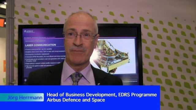
Airbus Defence and Space Brings Laser Communications to Earth Observation
0 Views0 Comments0 Likes
Earth Imaging Journal spoke with Jörg Herrmann, head of business development for the EDRS SpaceDataHighway Programme at Airbus Defence and Space, at the recent International Space Symposium. This laser-based data-relay system provides high-speed, near-real-time data transfer for Low Earth Orbit (LEO) satellites and airborne (unmanned/manned) platforms (UAS).
Environmental Applications Hold Promise for Ball Aerospace
0 Views0 Comments0 Likes
Ball Aerospace has been involved with the commercial and government sides of Earth-observation satellites for some time, including instrument and satellite construction for DigitalGlobe as well as the primary imager for the Landsat 8 satellite. Earth Imaging Journal spoke with Cory Springer, director of weather and environment at Ball Aerospace, about the prospects for environmental monitoring, the need to continue the data record for the Landsat program, the CAVIS instrument on DigitalGlobe’s WorldView-3 satellite that removes the impact of weather on the image, and the motivating role of the International Space Symposium.
Weather-Observation Gap Over Middle East Causes Consternation
0 Views0 Comments0 Likes
Exelis makes the majority of the weather and climate instruments for the U.S. government as well as Japan and Korea, including those that monitor greenhouse gases. Earth Imaging Journal spoke with Eric Webster, vice president and director for weather and climate systems at Exelis. His team has been working with the U.S. Air Force to study weather capabilities over Centcom (the Middle East and the Indian Ocean) that have been provided by a European weather satellite. The other weather instruments are owned by Russia and China, so there’s some concern about the source of this sensing going forward.
Airbus Defence and Space Launches WorldDEM DTM
0 Views0 Comments0 Likes
Airbus Defence and Space released its global elevation model that was captured by the twin TerraSAR-X and TanDEM-X radar satellites in 2014 and now is producing Digital Terrain Models based on this dataset. The 12-meter-resolution pole-to-pole elevation data are a major improvement upon the commonly used 30-meter USGS SRTM data. Earth Imaging Journal spoke with Gertrud Riegler, WorldDEM Product Manager, Airbus Defence and Space, at the International Space Symposium about this new dataset and its many uses.
Improving the Economics of Space through Greater Access
0 Views0 Comments0 Likes
Surrey Satellite Technology U.S. (SST-US) is an offshoot of the UK-based company that has now begun manufacturing satellites in its Denver-based offices to more efficiently address the U.S. market. Earth Imaging Journal spoke with John Paffett, CEO of Surrey Satellite U.S., about its continued mission to change the economics of space. Their recent development of the FeatherCraft platform, alongside partners NanoRacks and Aerojet Rocketdyne, takes advantage of the ease of deploying satellites from the International Space Station, adding propellant to increase the utility and life expectancy of a 100-kilogram-class satellite platform.
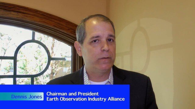
Earth Observation Industry Alliance Looks Forward to Further Proliferation
0 Views0 Comments0 Likes
The Earth Observation Industry Alliance (EOIA) was at the International Space Symposium talking to commercial space companies about the future of Earth observation. Earth Imaging Journal spoke with Dennis Jones, chairman and president of EOIA, about the outlook for Earth observation. The goals are to promote favorable policy, a corresponding regulatory environment that's less restricting and more supportive of new companies, and a larger government budget to support observation missions.
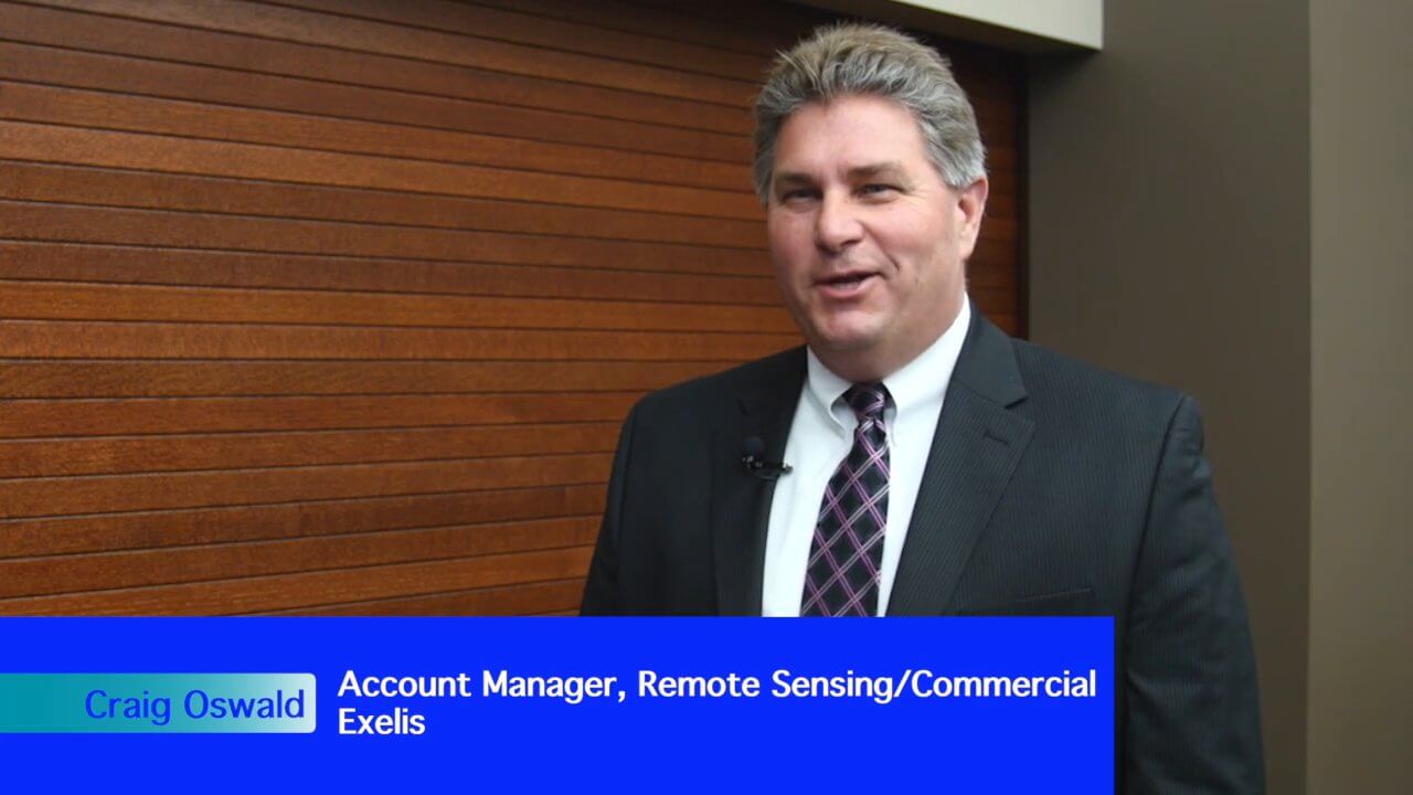
Exelis Aims at Small Satellite Sensor Development
0 Views0 Comments0 Likes
Earth Imaging Journal spoke with Craig Oswald, account manager for remote-sensing commercial markets at Exelis. We spoke about the smallsat market as well as maintaining high imagery quality while riding the faster, better, cheaper wave as Earth-observation satellites continue to proliferate.
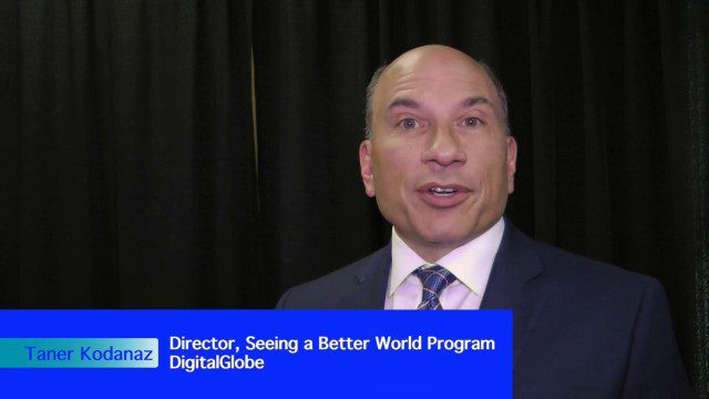
DigitalGlobe’s Seeing a Better World Program Focuses on Outcomes
0 Views0 Comments0 Likes
DigitalGlobe has expanded upon its theme of "Seeing a Better World," with a new program that focuses on themes aligned to the United Nations sustainable development objectives. Speaking with V1 Media, Taner Kodanaz, Director of DigitalGlobe's Seeing a Better World Program, describes how the company is leveraging its own imagery to provide greater context and outcome-oriented solutions around food and nutrition security, infrastructure development, sustainability, and human rights.
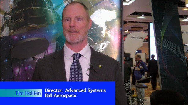
Ball Aerospace Delivers Science-Driven Sensors
0 Views0 Comments0 Likes
Ball Aerospace is a unique entity that delivers imaging instruments as well as full satellites, bringing scientists and engineers together to optimize sensor and spacecraft design. Earth Imaging Journal spoke with Tim Holden, director of advanced systems at Ball Aerospace, about sensor development, the commercialization of space and opportunities in remote sensing with increased temporal revisits.


